
Following intense public and professional backlash, Peru’s Ministry of Culture has reversed a controversial decision that had reduced the protected boundaries of the ancient Nazca Lines and surrounding geoglyphs. The government reinstated the original perimeter of 5,633.47 square kilometers (2175 square miles), restoring full coverage after experts, citizens, and heritage organizations raised concerns. The Ministry confirmed the reinstatement in a statement, stating the move upholds Peru’s responsibility to ensure long-term protection of the Nazca Lines.
The reversal also included the formal annulment of Viceministerial Resolution No. 128-2025, which had scaled back the protected area to just over 3,200 square kilometers (1235.527 square miles). The reduction, announced in late May, was based on studies that attempted to define which zones held the most archaeological value.
However, critics argued that the decision endangered lesser-known sites, exposed the area to illegal mining and farming, and weakened the country’s overall preservation framework.
Archaeologists, including the College of Archaeologists of Peru, warned that the move could set a damaging precedent for other heritage locations such as Caral and Machu Picchu.
“The original polygon not only protects the geoglyphs but also other archaeological sites that were within that limit. That delimitation allows, at least in theory, broader protection,” said Eyne Omar Bendezú De La Cruz, director of the School of Archaeology at the Saint Aloysius Gonzaga National University.
Bendezú, who is from the region, recently led a research team that discovered 29 previously unknown geoglyphs in the districts of El Ingenio and Changuillo. He stressed that such findings underscore the need for broader safeguards.

“The discovery of these new geoglyphs in El Ingenio and Changuillo is a contribution to Peruvian archaeology,” he said.
In response to the mounting criticism, the Ministry announced the formation of a new oversight body—the Nasca Executing Unit—tasked with managing the site.
Officials also ordered an urgent review of the current management plan, with revisions to begin within 10 days. A technical panel including archaeologists, government agencies, international experts, and UNESCO will guide the process.
Authorities stated that future zoning and land-use plans will reflect scientific consensus and public transparency. All technical documents related to site management will be published.
Despite efforts to formalize small-scale gold mining in the area—362 miners are registered under a government program—the region continues to face threats from unauthorized excavation, vandalism, and land invasions.
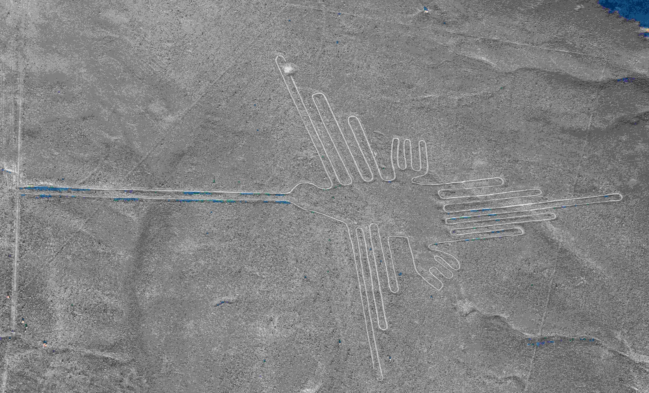
The Nazca plateau, located about 250 miles (400 km) south of Lima, is home to over 800 massive geoglyphs believed to have been created more than 1,500 years ago.
These ancient figures, including animals, plants, and geometric shapes, have earned global recognition since UNESCO declared the site a World Heritage location in 1994.
In its closing remarks, the Ministry reaffirmed its commitment to dialogue and protecting Peru’s cultural legacy.