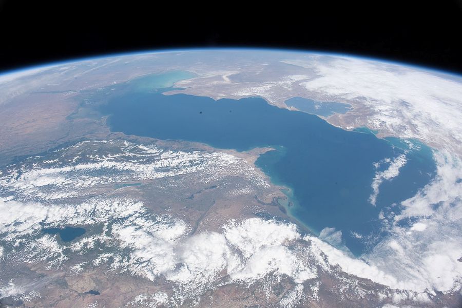

A new island has emerged in the northern waters of the Caspian Sea, according to Russian scientists who recently confirmed the find during a research expedition.
The island, located southwest of Maly Zhemchuzhny, became visible as the sea’s water level continued to fall—a development researchers attribute to both natural cycles and modern climate change.
The formation of the new island in the Caspian Sea was first noticed through satellite imagery in November 2024. What initially appeared to be a small mound of sand breaking the surface soon began to dry and take shape.
Although early observations sparked debate over whether it could truly be classified as an island, the recent expedition provided enough evidence to settle that question, at least for now.
Researchers from the Russian Academy of Sciences reached the site earlier this year and confirmed the presence of a sandy, flat mass just inches above sea level.
Poor weather and shallow waters prevented them from landing, but drone images revealed the island’s size and surface patterns, including visible sand ridges. The team reported that further investigation is needed to gain a better understanding of its structure and stability.
Russian scientists confirm a new island in the Caspian Sea, 30 km from Maly Zhemchuzhny. Formed due to falling water levels, the sandy landmass may expand soon—key for rare birds and Caspian seals.
Drone images captured the find. pic.twitter.com/aHZamdShQm— The Caspian Post (@thecaspianpost) May 29, 2025
Stepan Podolyako, a senior researcher at the P.P. Shirshov Institute of Oceanology, said the island likely appeared as a result of long-term shifts in sea level—a process that has happened before.
“Awash islands are uplifts on the seabed that come to the surface during periods of falling sea level,” Podolyako said in a statement. He explained that when water recedes, elevated portions of the seabed—often called awash islands—can rise above the surface.
The Caspian Sea, which spans the border of Europe and Asia, is the world’s largest inland body of water by surface area, covering more than 143,000 square miles.
Podolyako noted that similar sea-level drops occurred in the 1930s and 1970s, followed by periods of recovery. However, the current decline, which began around 2010, may be partially linked to rising global temperatures.
Evaporation, intensified by warmer climates, reduces the water volume in the basin. In addition to climate-related changes, researchers also point to tectonic activity beneath the seabed as a possible contributing factor to shifting water levels.
A second expedition to the island is planned for the latter half of 2025. Scientists hope to conduct on-site studies and possibly assign the island an official name.
Podolyako said the name could reflect distinctive features, if any are found, or honor someone with a significant cultural or scientific legacy tied to the region.
For now, the island remains low and vulnerable. As summer approaches and river flows into the Caspian Sea weaken, researchers expect the surrounding water levels to drop further, potentially increasing the island’s elevation above the surface.